"Nearview: Aerial Drone Mapping for Environmental Services" by James Msaddi
The owner has allowed the downloading of this poster:
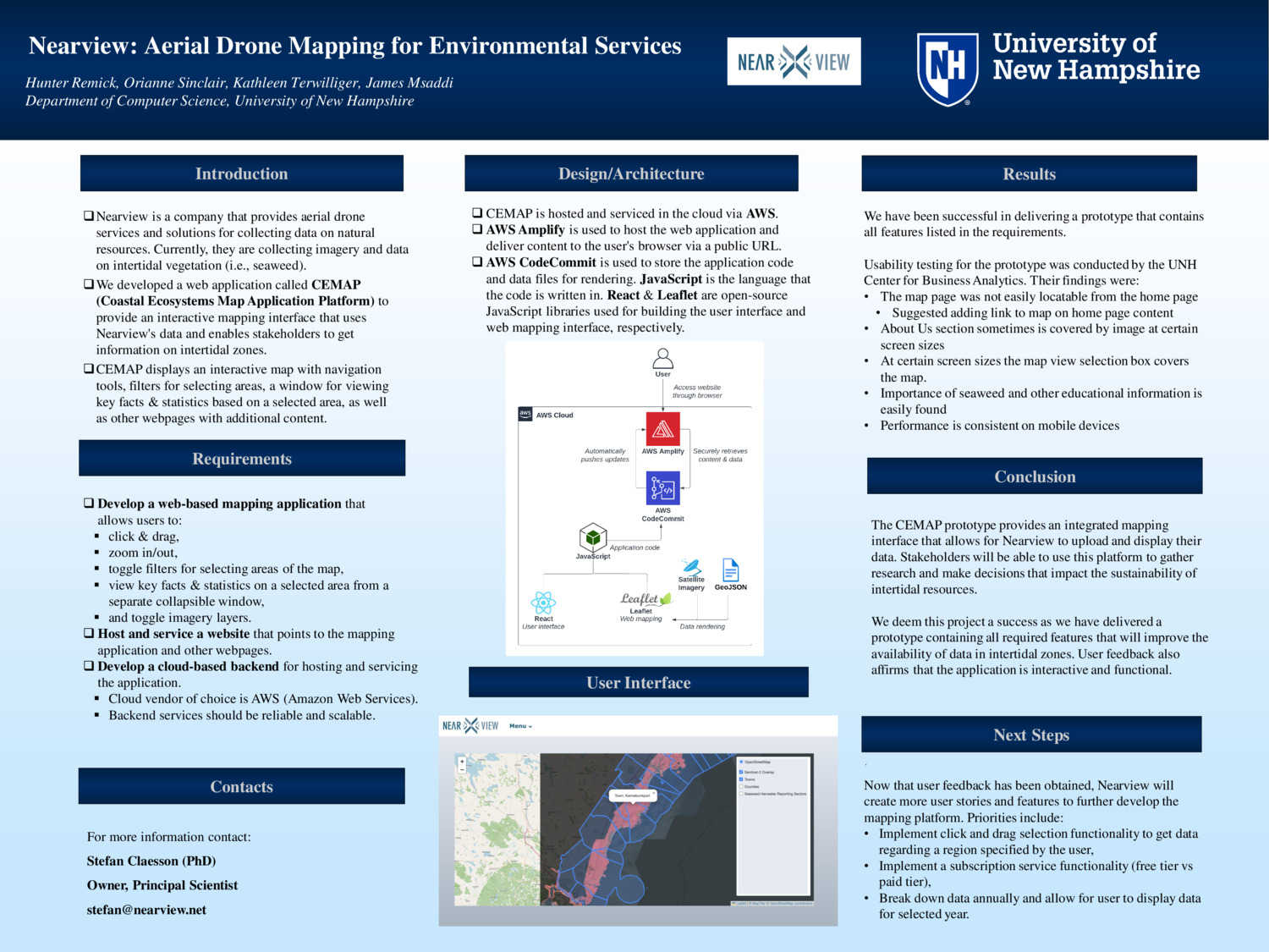
Here is the Original File
Image below may not exactly match the original file. This is due to pdf/pptx conversions. These will not be present in the printed version.
- Department:
- Email: jjm1090@wildcats.unh.edu